

Enzo, where did your idea come from?
During my thesis in Chile, I worked with satellite data to estimate surface temperatures from MODIS imagery and track glacier area changes over time using Landsat 8.
When I joined ATC Williams, I wanted to apply something similar to water body monitoring. For this application, I used Sentinel-2 instead of Landsat 8. Sentinel-2 has better spatial and temporal resolution.
What problem does your tool solve?
It’s possible from satellite imagery to identify and track different types of land cover over time, such as vegetation cover or water bodies. The tool allows users to:
- download imagery,
- apply spectral indices to classify features,
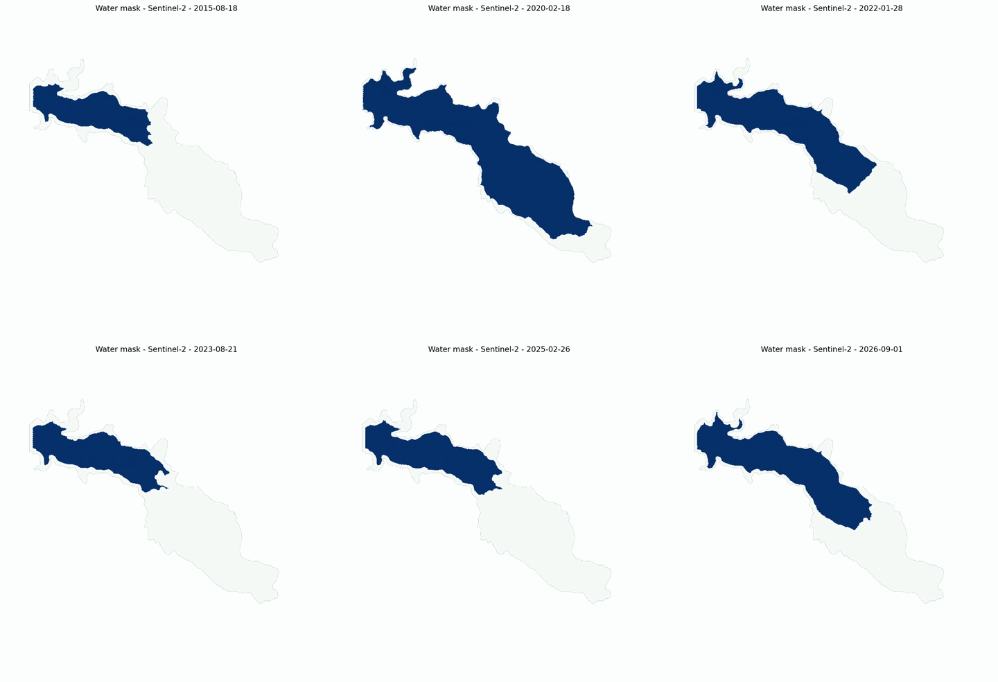
- estimate water body extent using NDWI (Normalized Difference Water Index), and
- save the results as a time-series in a CSV file.
Users can then export GeoTIFF files with the downloaded images and analysis outputs, as well as generate time-lapse videos showing how the area changes over time. Access to satellite imagery is provided through Microsoft Planetary Computer, a free platform.


Can you explain your process, any challenges or unexpected discoveries?
The main challenge was avoiding the need to download large raw satellite files every time an analysis is run. Satellite tiles can be quite large, which makes repeated analysis impractical on a standard work PC.
To solve this, the tool connects to Microsoft Planetary Computer, which stores satellite imagery in the cloud and allows users to download only the area of interest and the spectral bands needed. This keeps the tool fast and practical.
Through the interface, users define the area and time period, apply cloud cover filters and choose whether to download the best available image per month or all available images. The tool then produces a time-series of images, GeoTIFFs and a CSV with water extent over time.
What stage is your tool at now, and what is planned for the future?
The tool is fully operational and has been tested in Tasmania and New South Wales with good results. It will continue to be refined as it gets tested across more project types and locations. Future development includes support for additional satellite sources and analysis types.